Supersense 3D Free Flight

| Package ID: | |
|---|---|
| Latest Version: | v451.0 |
| Latest update: | Aug 14, 2024 11:32:05 |
| Developer: | MARIO DE QUEIROZ MONTEIRO |
| Requirements: | Android |
| Category: | Other |
| Size: | 11.30 MB |
| Tags: | Navigation Read |
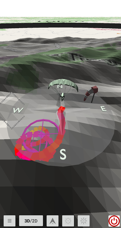
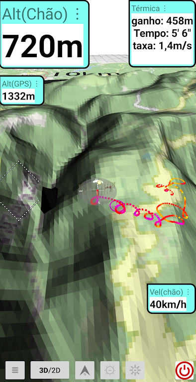
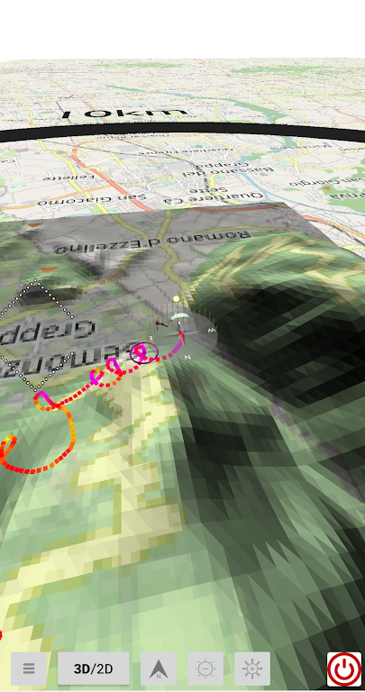
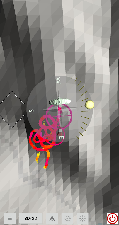
Supersense 3D Free Flight is an incredible app designed to revolutionize the way pilots navigate the skies. Offering a unique blend of cutting-edge technology and user-friendly features, this app allows pilots to map thermals during their flight through a mesmerizing 3D flight trail. With the ability to replay existing igc files, pilots can test the app's capabilities and explore intricate flight information effortlessly. The app's intuitive interface lets pilots customize their experience by choosing the location of infoboxes simply by dragging their finger. Additionally, pilots can select the font size to easily view vital information like GPS altitude, speed over ground, and more. For an unparalleled flying adventure, download Supersense 3D Free Flight now and explore the clouds like never before!
Features of Supersense 3D Free Flight:
> Free Flight Experience: Supersense 3D offers a captivating free flight experience, allowing pilots to navigate and explore the skies in a virtual 3D environment. Users can feel the exhilaration of soaring through the air without any constraints, making it an attractive choice for aviation enthusiasts.
> Thermals Mapping: One of the key features of Supersense 3D is its ability to support pilots in mapping thermals during flights. By analyzing the 3D flight trail, pilots can identify and track thermals, enhancing their understanding of air currents and improving their flying techniques.
> Intuitive Flight Information Display: The software is designed to provide flight information in a user-friendly and intuitive manner. Infoboxes display crucial information such as GPS altitude, speed over ground, and altitude above ground level. Pilots have the freedom to customize the display by dragging the infoboxes to their desired location and adjusting the text font size.
> Download Elevation Data: Supersense 3D offers the option to download elevation data from each continent. This data is sourced from the NASA project and made accessible through the SRTM project. By utilizing this feature, pilots can have access to accurate elevation data, aiding their navigation and flight planning.
Tips for Users:
> Test with Existing igc File: When using Supersense 3D for the first time, it is recommended to test the application by replaying an existing igc file. This allows users to familiarize themselves with the software's functionalities and see the flight trail in action.
> Customize Infoboxes: During the replay, pilots can take advantage of the feature to drag the infoboxes to their desired location. By adjusting the placement of the infoboxes, users can optimize their viewing experience and ensure that important flight information is easily accessible.
> Adjust Text Font Size: In addition to customizing the infoboxes' location, pilots can also adjust the size of the text displayed within the infoboxes. By double-clicking the infobox, a menu will appear, allowing users to choose their preferred font size for optimal readability.
Conclusion:
Supersense 3D offers a thrilling free flight experience, accompanied by features such as thermals mapping, intuitive display of flight information, and the ability to download elevation data. By providing a realistic and immersive environment, pilots can enhance their flying skills and gain a deeper understanding of air currents. Moreover, the ease of customization, from infobox placement to text font size, ensures a personalized and user-friendly interface. Whether you're a seasoned pilot or an aviation enthusiast, Supersense 3D is a must-have app for a truly captivating flight experience. Download it now and embark on your virtual aerial adventure.


